| Previous Day | Return to Lincoln Diary | Next Day |
Day 13 - Salt Lake City UT to Ely NV
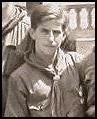 |
From the Diary of Eagle Scout Bernard R.
Queneau Member of the 1928 Lincoln Highway BSA Lincoln Highway Promotional Tour Friday, August 3, 1928 - On and on and on over the worst U.S. Route I ever hope to see. We finally reached McGill, a little Standard Oil Company town. Gas is cheap here at 35 cents. This is on account of hauling it out to New York, then refining it and then hauling it back. Then on to Ely. We made no stop at McGill, but it is a fair-sized town so I mentioned it. At Ely, we ate and went and saw the largest copper pit in the world. We then came back and made a water demonstration where we just froze. The last two days have been extremely interesting on account of their novelty. We went on to Eureka where we put on a demonstration in a once-a-week theatre. We stayed to the dance, and after helping a drunk fellow, we did not get to bed until 1:30. I had gotten up at 5:30. |
| Friday -
August 29th Today’s route includes an optional section of old Lincoln Highway that appears to have had little change since Bernie wrote about ‘the worst U.S. Route I ever hope to see.’ The booklet describes one 3-mile section as being badly warped and buckled, with a maximum safe speed of 5 mph. Although an alternate route on the Interstate has been provided, Bill decided to take us South along 36, eventually ending up on Route 50 to Ely (ee-lee). The scenery should be nicer, as we won’t be on the Interstate at all, and he wants to check out the possibility that Route 6/50 is an old southern route for the Lincoln Highway. |
 |
 |
 |
|
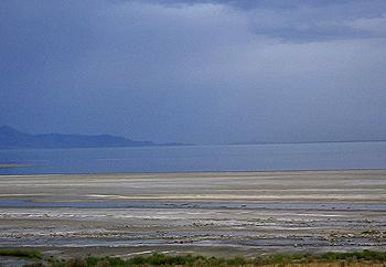
The sky is dark and ominous – there is rain forecast for the area later today. Given the weather we have had most of the trip, we can’t complain about one wet day. And we can see some sun pocking through the clouds to the south. Bill puts a fresh coat of Rain-X on the windshield and side glass, and we head for Ely. We follow Interstate 80 out of Salt Lake City, passing Saltair, where Bernie and his fellow Scouts suffered for only 35 cents each 75 years ago. There is a modern-looking building on the site now, looking almost like a mosque. |
 |
 |
 |
 |
|
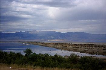
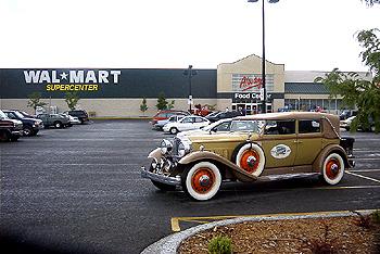
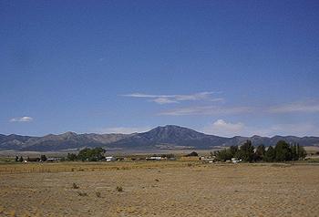
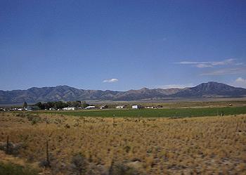
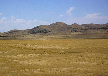
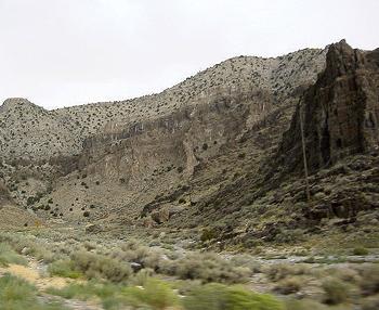
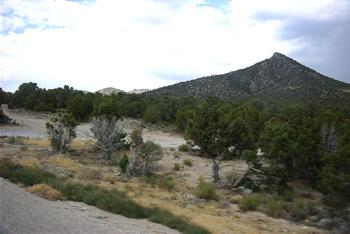
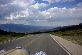
Passing the great Salt Lake, we turn South as soon as we can and follow a secondary highway through small towns. The last big town has a Wal-Mart, where we stop just to have a photo to show Marge Tillett, our super-shopper club-mate. There is no traffic on the road at all, and we are soon in desolate country again. The landscape gets steadily browner and rockier – it is obvious why the Mormons decided to stay where they were. Despite the barren scenery, this area is really beautiful. Not to mention quite different from Virginia. Once we get onto Route 6 and Route 50, the only vegetation is sagebrush and what Bill calls ‘Nebraska state trees’ – telephone poles (He is from Nebraska, he can say that!) One unmarked police car watches us roll by about 5 mph under the speed limit. We are the only car on the road, and after a few minutes, he rolls by us at a good clip. We see him again a couple of miles down the road, apparently hoping to catch Sophie with his radar gun. |
 |
 |
|
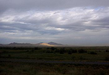
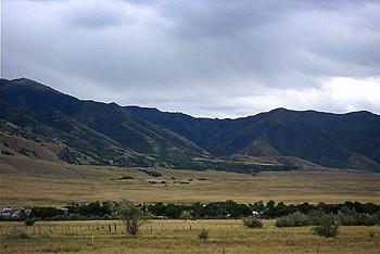
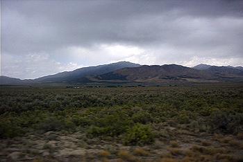
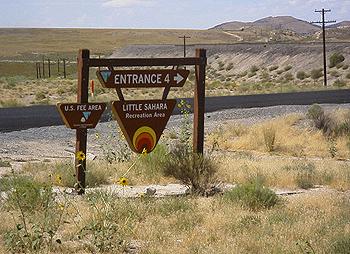
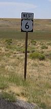
Route 50 is called ‘The Loneliest Highway in America.’ The Tour will be taking it from Ely to Fallon, NV tomorrow – we are starting it from the Eastern end. How lonely is it? We see a total of about ten cars in two hours of driving, and there is an 84-mile stretch with no town, no service station, no services at all! In a car that gets 8 mpg, we began to spend more time looking for gas stations than at the scenery! We are traveling through a high desert plateau, with very little signs of human habitation. There are open range signs and cattle crossing warnings, but we see only a handful of cattle grazing far off the road. Even the sign to a local camp site calls it ‘Little Sahara. The landscape reminds me a lot of the California Mojave desert where I was stationed in the Air Force. It has its own beauty, but is not for everyone. |
|
|
 |
|
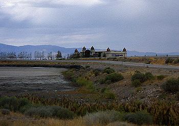
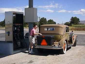
We finally find a town of some size with more than half a tank gone and another hundred miles to go. But where is the gas station? More disconcerting is the total lack of people. We drive around the small community, but don’t see a single person anywhere. As far as we can tell, the only living things in the town are a group of horses that watch us from under a grove of trees. (“More humans? I thought we ate them all!”) We head back to Route 50, somewhat mystified, only to spot a welcome Sinclair Fuel station – Bob’s Lynndle Sinclair, a one-stop convenience store that not only had gas, but provided a really great lunch. They even had a 36-flavor ice-cream counter! |
 |
 |
 |
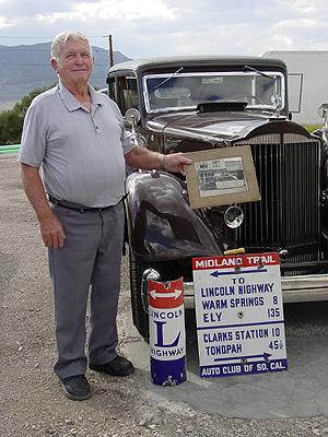
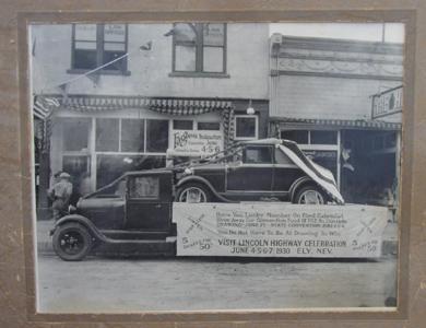
| Meanwhile, the main tour group had lunch at the Rainbow Peppermill Casino in Wendover, NV, then made an ice cream stop at McGill’s Historic Drug Store in McGill, NV. While they were at McGill, they were joined by local Marvin Ray, who brought along some original Lincoln Highway signs and a photo of a 1930 Model A giveaway that had been sponsored by the Lincoln Highway Association in Ely, NV. Marvin will be joining the tour tomorrow for the run from Ely to Fallon. (Bob and Shirley Woolfitt provided the great photos.) |
 |
 |
 |
|
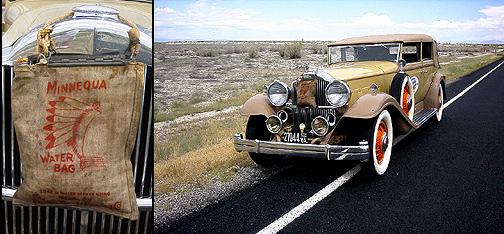
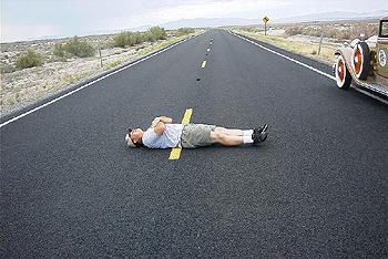
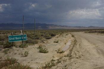
But that is not us. Back on the road with full stomachs and gas tank, we continue along the highway, this time searching for a good photo spot. TRAACA board member George Gurney loaned us a period water bag for the trip, and we want to make sure he sees it in use. The bag seems to be working well, though the constant dribble makes Sophie look incontinent. Ken Talley convinces me to lay down on the road for a silly shot – there is no traffic in either direction, but I don’t trust him. We motor on, getting strange looks and some waves from the few cars that go by. What are they thinking about us? Probably figuring we are a bunch of nutcases who are really, really lost. That’s ridiculous – we are only really lost. Actually, this is one of the few days where we have no navigational errors. It is easier when the only correct road is also the only paved one. One very official sign proclaimed a long dirt road to be ‘Great Basin Boulevard.’ It was actually a goat path with pretensions. |
 |
 |
 |
 |
|
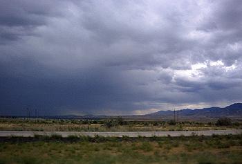
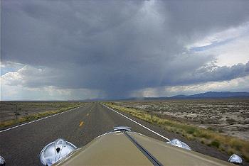
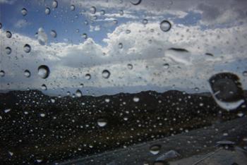
We find a gas station after another 80 miles, right on the Utah/Nevada border. As you might guess, the Nevada side of the building has slot machines. This is also the point where we switch to Pacific Standard Time. Ken and I use some of the extra hour to pay the slots. I end up ahead 15 cents overall, and leave a winner. As we enter Nevada, it becomes obvious that our luck in avoiding bad weather is going to run out. There is a huge cloud directly ahead, with lighting visible from 20 miles away. We hope that we will end up bypassing it, but even though we do avoid the worst, we get caught in a heavy downpour. |
 |
 |
 |
The rain doesn’t last long, however. Which is a good thing, since we have to climb over two mountains to get to Ely. Sophie takes the steep grades in stride, though we do have to slow down a good bit. As we drive out of the rain, the sky clears, and we have a dry ride the rest of the way into Ely. Most of the Tour is already checked in tot he hotel. There is a dinner sponsored in the local park by the White Pine Rodders tonight at 6 – that will mark the end of the day. Tomorrow, we continue on ‘The Loneliest Highway. |